Menu
-
- Home
-
About Us
-
The Approach
-
Linking Language & Literacy
-
MindWing Learning
-
Learning Resources
-
SHOP
-
Blog
-
- About MindWing
- Our People
- Contact Us
- Your Account
- Login
-
Spain (EUR €)

Exploring Settings with Google Earth
September 10, 2010 2 min read
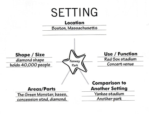
In this post, I will be continuing to describe resources to supplement the lessons in It’s All About the Story, and moving on to the element of Setting. Setting is a key area of instruction for students on the autism spectrum not only because they tend not to observe the “expected behaviors” or script for a given setting, but also because they often leave out details about setting when telling stories to others, thus resulting in loss of a point of reference and confusion on the part of their listener. Students in social thinking/skills groups or individual treatment would therefore benefit from building descriptive skills through the use of the Setting Map contained in It’s All About the Story and other SGM resources. Once again, as visual and kinesethetic learners, working with resources they can see and manipulate assists in building these skills.

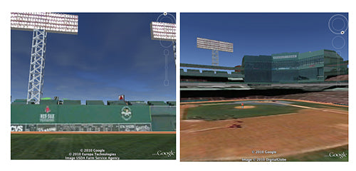
A good example of a Setting Map is the description of Fenway Park contained in It’s All About the Story. Although such a description could be elicited from memory, using a visual resource such as a storybook is likely to be a great scaffolding technique. Yet another option is to explore settings using Google Earth, a free, interactive virtual globe that allows you to explore locations close-up and in 3D! Here are a few views of Fenway I was able to bring up with just a few steps in Google Earth:

Check out this screencast on some simple navigation functions to get you going and manipulating views with Google Earth.
Google Earth can be downloaded for free, and the Google Earth Plugin allows you to use it in your web browser without opening another program. This is useful if you would like an even simpler, no-frills lesson using Google Maps. While an exciting location such as Fenway Park will be an attention grabber, it would also be helpful to contrast with more everyday locations such as a neighborhood park, school, mall, or hospital, as visualized in Google Earth or Maps. Enjoy, and don’t miss the great free Google Earth apps available for iPhone/iPod Touch and iPad.
Leave a comment.
Comments will be approved before showing up.
